Friends of The High Lakes OHV Camping map |
To download the map below, right click the image. |
Here's a .pdf if you prefer: HERE |
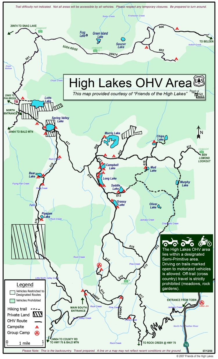 |
| A large map of the whole area - 4608 x 4960 - 5.1 MB - not dialup friendly |
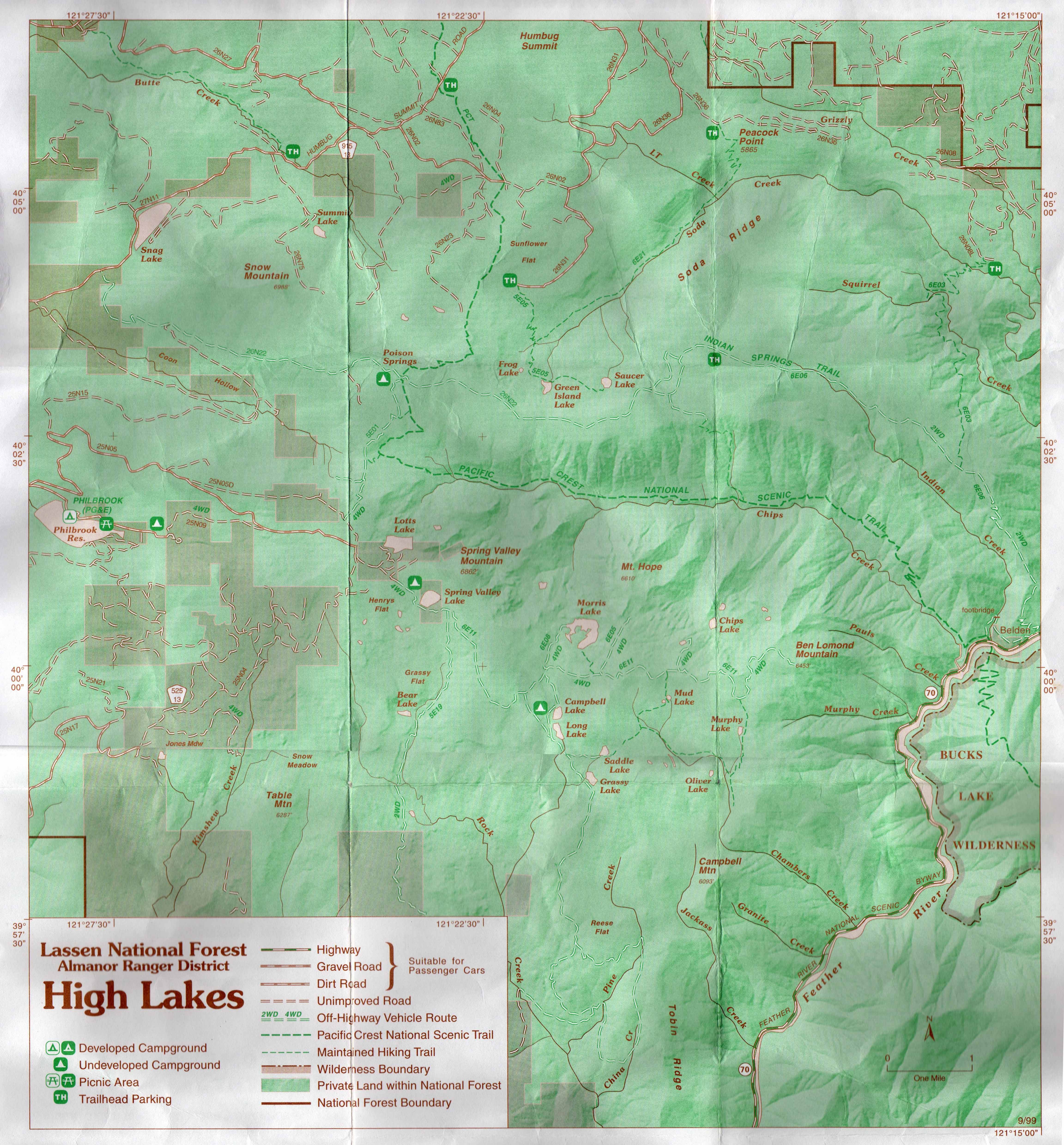
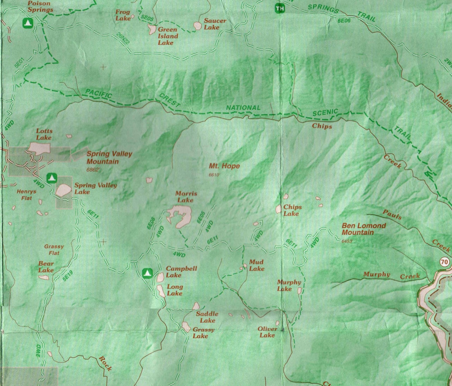
| 1999 Forest Plan Map | ||
| 1933 Lassen National Forest Map |
| 1948 CDF Map | ||
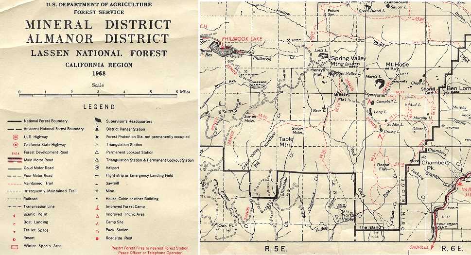
| 1968 Lassen N.F. Map |
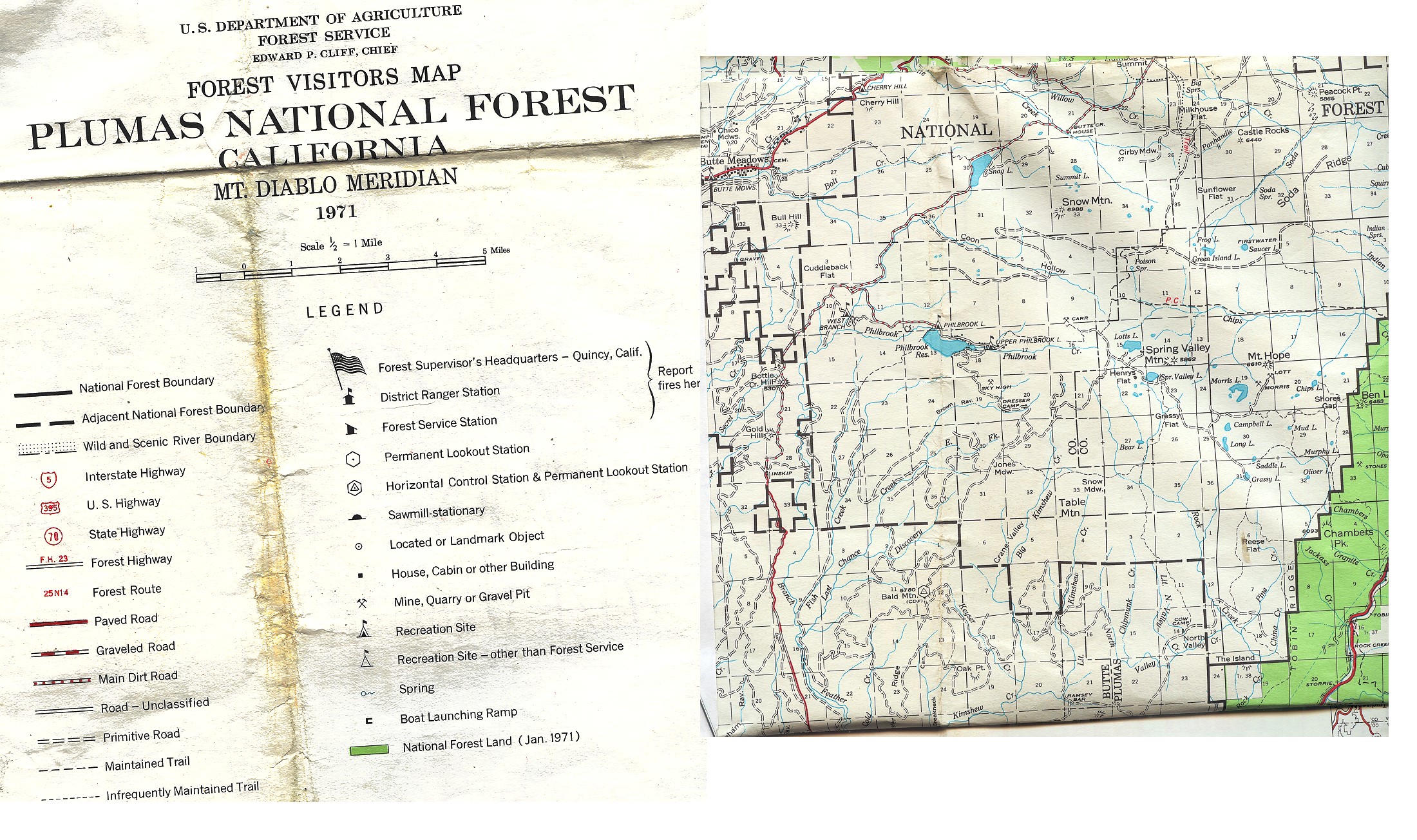
| High Lakes on 1971 Plumas N.F. map |
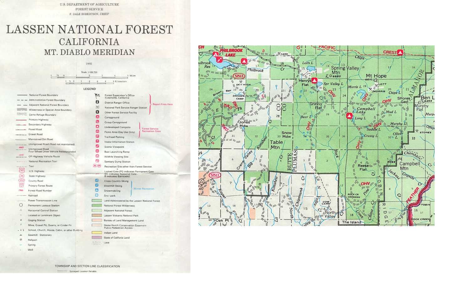
| 1992 Lassen N.F. Map | ||